
The indigenous Carib Kalinago people called the island Wai’tukubuli, meaning ‘Tall is her body’ because it is so mountainous. Dominica is the Latin name given by Christopher Columbus to the island when he sighted it on Sunday 3 November 1493 during his second voyage and christened it ‘Dies Dominica’, for “the day of the Lord”. In French it is La Dominique. It first appears on a map of the world in 1500.
The island of Dominica must not be confused with the Dominican Republic, which is the Spanish speaking nation that shares the island of Hispaniola with Haiti in the Greater Antilles. Dominica was colonized by France and Britain.
It gained its independence from Britain on 3rd November 1978 under the official title of The Commonwealth of Dominica and it is a republic with its own national head of state. The system of government follows the pattern of the British Westminster system with general elections held roughly every five years. English is the official language, but a French based Creole (Kwéyole) language is widely spoken. The place names of Dominica reflect its past as they are in three languages: Kalinago, French and English.
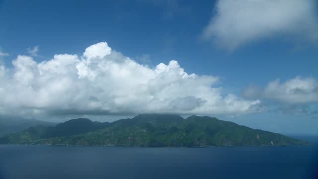
Geologically, Dominica is a volcanic island that lies along the edge of the Caribbean tectonic plate. It is considered to be the most mountainous island in the Caribbean. A Boiling Lake and numerous fumaroles and hot water springs dot the island indicating its volcanic origins. Its tallest peak, Morne Diablotin, is 1447 meters high (4447 ft).
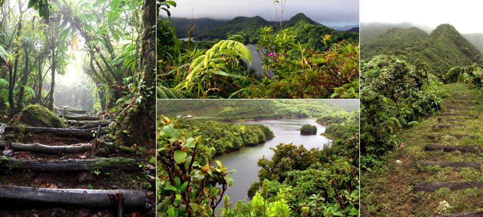
This topography has created various micro-climates that has resulted in six major vegetation zones which supports a wide variety of flora and fauna. Some eighty rivers and streams flow into the sea and each river is connected to several tributaries. Because an accurate number of these streams is uncertain, Dominicans like to simply say that we have 365 rivers – one for every day of the year.
The outstanding tropical nature of Dominica gives it the popular brand name “Nature Island of the Caribbean”. There are three main crater lakes: The Freshwater Lake, The Boeri Lake and the Boiling Lake. There are dozens of waterfalls. The most visited are the Trafalgar Falls, Middleham Falls, Jacko Falls, Spanny’s Falls, Sari falls, Victoria Falls and Milton or Syndicate Falls in the north of the island. The Emerald Pool is a pristine river pool surrounded by rain forest. Other popular river basins are the Chaudiere Pool, The York Valley Pool and the Rosalie and White River pools along the east coast.
Because of its volcanic nature, most of the main beaches on the west coast of the island are made up of sparkling black and grey sand but there are also coral beaches along the north coast. There are three national Parks. The largest is the Trois Pitons National Park in the southern central part of the island; the Cabrits National Park in the north and the Morne Diablotin National Park around the island’s highest peak.
The steep mountains, rising above many of the other peaks which make up the chain of the Lesser Antilles, brings rain and with it thickly forested slopes and well-watered valleys. This environment gave the early Kalinago islanders a natural fortress against the European settlers and kept Dominica uncolonized for a longer period than other islands. In fact, Dominica was the last island in the Caribbean to be officially colonized.
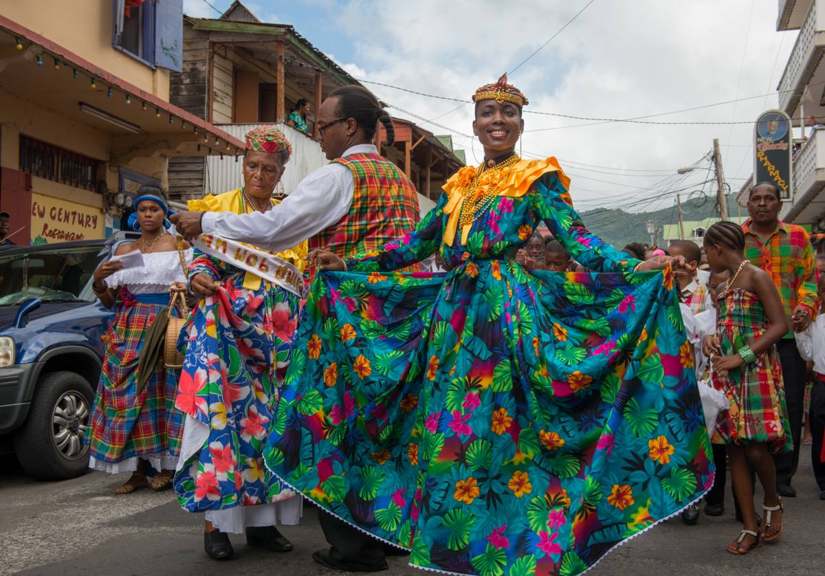
The first human beings to settle on the island arrived some 4000 years ago from South America. Since 1493, a mixture of Amerindians, Africans and Europeans have occupied the island. Therefore, the population is made up of the descendants of indigenous Carib or Kalinago people, the mixed descendants of settlers from France and Britain and the descendants of West Africans who were enslaved and transported to work on plantations between the 1690’s and 1807. The traditional culture and folklore are a combination of these influences. Lebanese, Chinese and some East Indians make up the rest of the population. Christianity is the main religion, with Roman Catholics forming the largest denomination, followed by Methodists, Pentecostals, Baptists, Anglicans, and numerous small evangelical churches.
Primary occupations are farming and fishing, commercial activity, government service, and tourism. The population is in the region of 69,000 persons. Most of the population live along the coastal zone of the island in some fifty communities. The capital city is Roseau on the south-western coast, while the second town of Portsmouth is located at the best harbour and largest bay, Prince Rupert’s Bay, on the north west coast.
The steep topography of the island prevented the development of very large plantations and cut down on the profits of sugar and coffee. The forests gave the enslaved who escaped from the plantations, protection from slavery, and a chance to enjoy liberty as “Maroons” in the mountainous forests. Later, it provided the freed slaves with land to begin a peasant farming society. Well into the twentieth century, the terrain made communications difficult and hindered developments such as roads, electricity and the construction of an airport. But since the 1950s these challenges have been overcome and the island is well connected internally and with the outside world, including cutting edge telecommunication services.
